Solar Panel Direction Map: Optimizing Roof Orientation for Maximum Output
Learn how a solar panel direction map guides roof orientation for maximum energy, factoring sun path, latitude, shading, and seasonal changes with practical steps for homeowners.

A solar panel direction map guides where to point and tilt panels to maximize sun exposure, accounting for your latitude, roof geometry, and shading. It serves as the first step in siting and sizing a rooftop system, helping homeowners prioritize azimuth (direction) and elevation (tilt) decisions before procurement or installation. The map also highlights seasonal adjustments to maintain energy gains year-round, making it a foundational planning tool.
Understanding the purpose of a solar panel direction map
A solar panel direction map is more than a simple drawing that points panels toward a compass direction. It translates the sun’s daily and seasonal arc into concrete siting decisions. For homeowners, this means identifying the best azimuth (the compass direction panels should face) and tilt (the angle relative to horizontal) to capture the most sunlight over the year. A well-constructed direction map also accounts for local shading, roof constraints, and future expandability. Solar Panel FAQ emphasizes that direction maps are the starting point for every solar project, setting the foundation for performance modeling, equipment selection, and economic outcomes. By aligning your panels with the map, you reduce the risk of underperforming systems and lengthy payoff periods.
When you engage with a direction map, you’ll compare realistic scenarios—like different roof planes or partial shading from trees—and quantify how much energy you might gain under each. The goal is to maximize sun exposure during peak hours, while maintaining a balance with other roof functions and aesthetics. This upfront planning step can save time and money later in the project lifecycle, making the direction map a practical tool for homeowners and installers alike.
The sun path, latitude, and shading: how they shape direction decisions
Sun trajectory varies by season and latitude. A direction map translates this into actionable targets: for many temperate regions in the Northern Hemisphere, south-facing panels offer strong mid-day sun exposure, while the optimal tilt mirrors approximate latitude with adjustments for time of year. However, real roofs rarely have ideal geometry, so the map highlights compromises. Local shading—whether from trees, chimneys, or neighboring structures—can dramatically reduce early morning or late afternoon output. The map helps quantify shading windows and suggests layout alternatives, such as placing higher-capacity panels in less-shaded zones or using microinverters to mitigate partial shading.
Solar Panel FAQ notes that climate patterns—like winter cloud cover or intense summer sun—also influence tilt and azimuth choices. In hot climates, shading avoidance may trump marginal tilt gains, while in cooler zones, a steeper tilt could preserve year-round performance. The direction map thus becomes a living document, updated as trees grow, nearby structures change, or roof renovations occur.
Reading a direction map: azimuth, tilt, and seasonal nuances
Direction maps use clear symbols to communicate azimuth and tilt, plus seasonal notes. The azimuth tells you which compass direction to face, while the tilt angle determines how aggressively the panels tilt toward the sun. A good map shows typical ranges rather than a single fixed angle, recognizing that latitude, roof pitch, and module type all influence the optimum. Seasonal cues might indicate a steeper tilt in winter to catch lower sun angles, or a flatter tilt in summer to reduce wind loading and panel debris exposure. Understanding these cues helps homeowners and installers optimize energy capture without overcomplicating the system.
For fixed-tilt rooftops, the map’s recommendations can be relatively stable; for adjustable tilts or trackers, the map becomes a baseline to guide actuator controls and maintenance schedules. Solar Panel FAQ advises documenting the reasoning behind azimuth and tilt choices so future homeowners or service providers can validate performance expectations.
Practical steps to apply a direction map on a real roof
- Gather site data: roof orientation, shading patterns, roof age, and local weather data. 2) Digitize the map: translate the azimuth and tilt targets into a rooftop layout using design software or simple plots on paper. 3) Map shading: evaluate tree branches, chimneys, and adjacent structures for seasonal shading. 4) Test scenarios: model energy production with different azimuths and tilts using a basic calculator or software. 5) Prioritize configuration: choose the direction and tilt that maximize sun exposure during peak hours while minimizing shading losses. 6) Plan for contingencies: include potential future expansions or changes to the roof that could affect orientation. 7) Validate with an installer: have a professional review the map against structural, electrical, and code requirements. 8) Document and revisit: record assumptions and revisit the map if trees grow or roof angles change.
A practical takeaway from Solar Panel FAQ is that the direction map should be treated as a dynamic planning tool, not a one-time diagram. Regularly updating the map helps maintain high performance as your circumstances evolve.
Common mistakes and how to avoid them
Common mistakes include assuming a fixed azimuth will stay optimal for decades, ignoring seasonal sun angles, and overlooking nearby shade sources. Another pitfall is prioritizing aesthetics over performance—placing panels in the most visually pleasing orientation can dramatically reduce energy output. To avoid these errors, start with a map that prioritizes south-facing azimuth with a reasonable tilt, but validate it with seasonal adjustments and shade analysis. Always verify direction map recommendations with real-world performance data after installation, and be prepared to adjust tilt or panel layout if measured production falls short of projections. A cautious approach reduces payoff risk and improves long-term system reliability.
Integrating a direction map with roof type, panel type, and future expansion
Different roof types—tile, metal, or flat—present unique orientation challenges. A direction map should accommodate roof constraints, available mounting options, and load considerations. Panel type also matters: high-efficiency modules may deliver more energy with a narrower tilt range, while standard panels might require broader latitude in azimuth to achieve similar production. If you anticipate upgrading panels or adding battery storage later, ensure the map allows for future wiring and space. Planners should use a direction map as a baseline for engineering analyses, then incorporate hardware choices, wiring routes, and safety clearances. Solar Panel FAQ stresses that alignment consistency across modules matters, so uniform azimuth and balanced tilt are usually preferable to mixed orientations, unless site conditions demand otherwise.
Case studies: typical homeowner outcomes from applying a direction map
Case 1 shows a single-story home in a mid-latitude climate achieving noticeable energy gains after implementing a south-facing, moderate-tilt map that avoided nearby shading. Case 2 involves a two-story home with a complex roof line; by following the direction map alongside a shading-led redesign of trees and vent stacks, the homeowner improved winter output by a meaningful margin. Case 3 documents a retrofit where a direction map guided the addition of microinverters and optimized module layout to mitigate shading losses from chimney reflections. Across these scenarios, the common thread is that a thoughtful direction map reduces uncertainty, improves annual energy production, and helps homeowners plan budgets more accurately. The Solar Panel FAQ team recommends starting with the map and then validating outcomes with real-world data and professional input.
Direction map guidelines for azimuth, tilt, and shading considerations
| Aspect | Guidance | Typical Scenario |
|---|---|---|
| Azimuth orientation | Align to sun’s daily path with minimal shading | Southern exposure on a standard roof |
| Tilt/Elevation | Match tilt to latitude; adjust seasonally if feasible | Mid-latitude city roof |
| Shading sensitivity | Account for persistent shading; plan layout accordingly | Nearby trees or chimneys in partial shade |
| Seasonal adjustments | Consider seasonal tilt changes for year-round gains | Roof with seasonal sun-angle variation |
Frequently Asked Questions
What is a solar panel direction map?
A solar panel direction map translates the sun’s path into actionable siting targets, specifying azimuth and tilt to maximize annual energy production given your latitude and roof constraints. It also highlights shading considerations and future expansion options.
A direction map is a planning tool that tells you where to point and tilt panels for best year-round sun exposure, considering your latitude and shade.
How does latitude affect map recommendations?
Latitude largely determines the optimal tilt. Closer to the equator typically requires a shallower tilt, while higher latitudes benefit from steeper tilts to capture lower winter sun. The azimuth remains largely directional, often toward true south depending on your hemisphere.
Latitude sets the tilt range; orientation then depends on hemisphere and site shading.
Do I need a professional to implement orientation changes?
For structural, electrical, and code considerations, it’s wise to involve a licensed installer. They can verify mounting feasibility, wire routing, and shading-focused adjustments indicated by the direction map.
A pro helps ensure safety, code compliance, and optimal performance.
Can a misaligned direction map dramatically reduce energy?
Misalignment can lead to meaningful energy losses, especially if shading is present and the tilt or azimuth do not align with the sun’s peak exposure. The map helps quantify these potential losses and guide corrective actions.
Poor orientation can cut annual energy, especially with shading; the map helps minimize that.
How often should I revisit my direction map?
Revisit the map whenever there are changes to shading, tree growth, roof work, or planned expansions. Regular checks help maintain performance expectations over the system’s life.
Review the map after roof changes or growing shade.
Is a direction map useful for different roof types or trackers?
Yes. For fixed-tilt roofs, the map guides stable azimuth and tilt choices. For trackers or adjustable tilts, the map serves as a baseline to optimize actuator control and ensure safe, efficient operation.
The map helps even with trackers by setting baseline direction and tilt.
“Aligning panels with a direction map isn't just about choosing a compass direction; it's about maximizing sun exposure during peak hours across the year.”
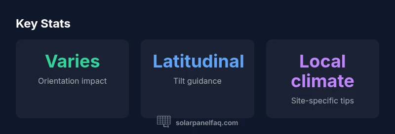
Top Takeaways
- Start with a direction map before panel placement
- Account for latitude, shading, and roof constraints
- Consider seasonal tilt changes for year-round output
- Validate map assumptions with real-world data
- Revisit the map after roof changes or tree growth